MethaneWatch
The fight against global warming
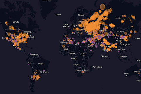
The MethaneWatch project is at the heart of current concerns about global warming. Indeed, methane is considered a key element in leaving dependence on coal. It is therefore fundamental to ensure that its use is not also a significant source of greenhouse gases. Monitoring and controlling methane emissions is therefore essential to continuing the fight against global warming.
Satellite monitoring
The goal of this project is to develop an automatic global monitoring system on a daily basis using satellite imagery.
The wide variety of satellites that can be used to track methane emissions from space has led to look at different facets of this problem:
- automatic detection, using neural networks or conventional methods,
- quantification,
- the use of temporally sparse data but with good hyperspectral resolution (for example hyperspectral imaging with the PRISMA and EnMaP satellites),
- the use of data with poor spectral resolution but a low revisit time, a good spatial resolution and a low acquisition cost (for example the satellites of the Sentinel-2 constellation or even geostationary satellites like GOES or in the very near future Meteosat MTG).
A fruitful collaboration with an industrial partner
This work was carried out in collaboration with the French company Kayrros, the laboratory LSCE (Laboratoire des Sciences du Climat et de l’Environnement), the Institute OPSL (Institut Pierre-Simon Laplace), with the help of CNES (Centre national d'études spatiales) and ESA (European space agency). This collaboration notably made it possible to develop the homonymous product MethaneWatch within the framework of the United Nations Environment Program, whose aim is to develop the plateform Methane Alert and Response System (MARS).
This collaboration provided an opportunity to take part in blind evaluation experiments organised by Stanford University: the methods and algorithms developed during the project could thus be validated on many different sensors.
Press review
The results of these studies have a great societal impact: they have received wide media coverage. These include press articles in
- Washington Post (2021), Russia allows methane leaks at planet's peril
- the Guardian (2023), 1,000 super-emitting methane leaks risk triggering climate tipping points
- Bloomberg (2023), Giant methane leak in Kazakhstan shows climate risk of gas exploration
- BBC Mundo (2023), Cambio climático: qué son los eventos superemisores
- Discover magazine (2021), Oil And Gas Industry Has Suffered 800 Major Methane Leaks Since 2017
- CNES (2024), Methane Watch : les fuites de méthane mesurées depuis l’espace sur toute la planète

A representative example of the work carried out
Global Tracking and Quantification of Oil and
Gas Methane Emissions from Recurrent Sentinel-2 Imagery, Environ. Sci. Technol. 2022, 56, 14, 10517–10529
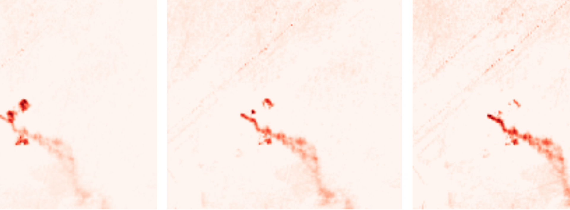
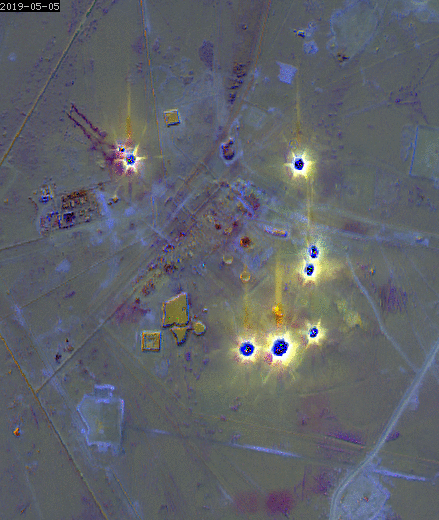
The authors T. Ehret, A. De Truchis, M. Mazzolini, J.-M. Morel, A. d’Aspremont, T. Lauvaux, R. Duren, D. Cusworth, G. Facciolo have demonstrated that it is possible to monitor oil and gas infrastructure across the globe using recurrent Sentinel-2 recurrent imagery to detect and quantify more than 1,200 significant methane emissions.
In combination with emission estimates from airborne measurements and daily low-resolution satellite measurements, they demonstrated the robustness of the fit to a power law for all emission scales, from large-emitters to ultra-emitters. They conclude that the prevalence of ultra-emitters detected overall by Sentinel-5P is directly linked to occurrences of emissions that are below its detection threshold, and which correspond to the large emitters observed by Sentinel-2. This power law is also validated on a more local scale. This study is extremely important because it provides bounds for estimating global methane emissions from the oil and gas sector.
Publications
-
Model Adjusted Generalized Tests for Methane Plume Detection on Hyperspectral Images, Ouerghi, E. et al., 2023 13th Workshop on Hyperspectral Imaging and Signal Processing, IEEE
-
Detecting methane plumes using prisma: Deep learning model and data augmentation, Groshenry, A. et al, 2022.
-
Automatic methane plumes detection in time series of sentinel-5p L1b images, Ouerghi, E. et al, ISPRS Annals of the Photogrammetry, Remote Sensing and Spatial Information Sciences, 2022.
-
Methane Plumes Detection on Prisma L1 Images with the Adjusted Spectral Matched Filter and Wind Data, Ouerghi, E. et al, IEEE Int. Geoscience and Remote Sensing Symposium, 2023
-
Automatic Methane Plume Quantification Using Sentinel-2 Time Series, Ehret, T. et al, IEEE Int. Geoscience and Remote Sensing Symposium, 2022
-
Detection of methane emissions using pattern recognition, Ouerghi, E. et al, IEEE Int. Geoscience and Remote Sensing Symposium, 2021
-
Detection of methane plumes in hyperspectral images from sentinel-5p by coupling anomaly detection and pattern recognition, Ouerghi, E. et al, ISPRS Annals of the Photogrammetry, Remote Sensing and Spatial Information Sciences, 2021.